 by Angela Guess
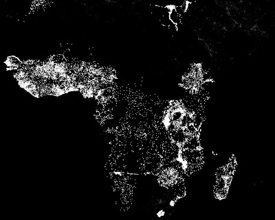
Glen Martin reports in Stanford News, “One of the biggest challenges in fighting poverty is the lack of reliable information. In order to aid the poor, agencies need to map the dimensions of distressed areas and identify the absence or presence of infrastructure and services. But in many of the poorest areas of the world such information is rare… A new poverty mapping-technique developed by interdisciplinary researchers at Stanford offers cause for hope. The technique is based on millions of high-resolution satellite images of likely poverty zones. To analyze these images, the researchers used machine learning, a discipline within the broader field of artificial intelligence. In machine learning, scientists provide a computational model with raw data and an objective – but do not directly program the system to solve the problem. Instead, the idea is to design an algorithm that learns how to solve the puzzle by combing through the data without direct human intervention.”
Martin goes on, “The researchers began their poverty-mapping project knowing that nighttime lights provide an excellent proxy for economic activity by revealing the presence of electricity and the creature comforts it represents. That was half of the raw data that their system needed. ‘Basically, we provided the machine-learning system with daytime and nighttime satellite imagery and asked it to make predictions on poverty,’ said Stefano Ermon, assistant professor of computer science. ‘The system essentially learned how to solve the problem by comparing those two sets of images.’ Burke, Ermon and fellow team members David Lobell, an associate professor of Earth system science, undergraduate computer science researcher Michael Xie and electrical engineering PhD student Neal Jean detailed their approach in a paper for the proceedings of the 30th AAAI Conference on Artificial Intelligence.”
photo credit: Stanford